
| Distrito de Toggenburgo Wahlkreis Toggenburg | ||
|---|---|---|
| Distrito | ||
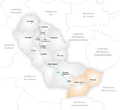
 Ubicación de Distrito de Toggenburgo | ||
| Coordenadas | 47°17′58″N 9°05′13″E / 47.299444, 9.086944 | |
| Capital | Lichtensteig | |
| Idioma oficial | Alemán | |
| Entidad | Distrito | |
| • País |
| |
| • Cantón |
| |
| Comunas | 15 | |
| Superficie | ||
| • Total | 488 km² | |
| Altitud | ||
| • Media | 794 y 968 m s. n. m. | |
| Población (2008[1]) | ||
| • Total | 44 947 hab. | |
| • Densidad | 91,96 hab/km² | |
| Huso horario | UTC+01:00 y UTC+02:00 | |
| Matrícula | SG | |
El distrito de Toggenburgo (en alemán Wahlkreis Toggenburg, hispanizado Círculo electoral de Toggenburgo) es uno de los ocho distritos del cantón de San Galo, Suiza. Tiene una superficie de 488,75 km².
Geografía
El distrito de Toggenburgo se encuentra situado en la región del antiguo Toggenburgo. Limita al noreste con el distrito de Wil, al este con el cantón de Appenzell Rodas Interiores, al sureste con el de Werdenberg, al sur con el de Sarganserland, al suroeste con el distrito de See-Gaster, al oeste con los de Hinwil (ZH) y Pfäffikon (ZH), y al noroeste con el de Münchwilen (TG).
Comunas
| Distrito de Toggenburgo | ||
|---|---|---|
| Comunas | Población (31.12.2008[2]) |
Superficie km² |
| 3359 | 13.79 | |
| 4885 | 43.57 | |
| 1187 | 8.01 | |
| 936 | 20.15 | |
| 8107 | 42.59 | |
| 255 | 7.23 | |
| 1842 | 2.82 | |
| 1371 | 14.09 | |
| 2975 | 50.46 | |
| 4151 | 49.03 | |
| 3333 | 80.63 | |
| 1355 | 12.68 | |
| 381 | 12.24 | |
| 8174 | 43.93 | |
| 2636 | 87.53 | |
| Total (15) | 44 947 | 488.75 |
Cambios desde 2000
-

Comunas hasta 2004
-

Comunas hasta 2008
-
Comunas hasta 2009


Fusiones
- 2005: Krummenau y Nesslau → Nesslau-Krummenau
- 2009: Brunnadern, Mogelsberg y Sankt Peterzell → Neckertal
- 2010: Alt Sankt Johann y Wildhaus → Wildhaus-Alt St. Johann
Referencias
- ↑ Oficina federal de estadística (31 de diciembre de 2008). «Population résidante moyenne selon les communes» (en francés). Consultado el 3 de septiembre de 2009.
- ↑ Oficina federal de estadística (31 de diciembre de 2008). «Population résidante moyenne selon les communes» (en francés). Consultado el 3 de septiembre de 2009.
 Datos: Q693185
 Multimedia: Toggenburg (Wahlkreis) / Q693185