
| East Renfrewshire East Renfrewshire / Siorrachd Rinn Friù an Ear | ||
|---|---|---|
| Concejo | ||
 | ||
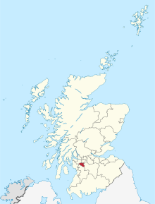 Localización de East Renfrewshire en Escocia. | ||
| Coordenadas | 55°47′54″N 4°17′27″O / 55.7984, -4.2907 | |
| Capital | Giffnock | |
| Entidad | Concejo | |
| • País |
| |
| • Nación constitutiva |
| |
| Superficie | Puesto 28.º | |
| • Total | 174 km²[1] | |
| Población (2011) | Puesto 24.º | |
| • Total | 90 574 hab.[2] | |
| • Densidad | 548,24 hab./km² | |
| Sitio web oficial | ||
East Renfrewshire (en gaélico escocés: Siorrachd Rinn Friù an Ear) es un concejo de Escocia (Reino Unido).[3][4] Limita con los concejos de North Ayrshire, East Ayrshire, Renfrewshire, South Lanarkshire y Glasgow. La capital administrativa es Giffnock.
East Renfrewshire pertenecía al antiguo condados de Renfrewshire hasta 1975. Desde ese año perteneció a la región de Strathclyde hasta que en 1996 volvió a modificarse la organización administrativa de Escocia y se formó el nuevo concejo de East Renfrewshire con el territorio del antiguo distrito de Eastwood y añadiéndosele la localidad de Barrhead que pertenecía al distrito de Renfrew.
YouTube Encyclopedic
-
1/3Views:11 6204 988826
-
Isobel Mair School Tour - Newton Mearns Scotland 2012 for East Renfrewshire Council by Moving Films
-
Early Years - Busby, Carolside and Netherlee Nursery by Moving Films for East Renfrewshire Council
-
East Renfrewshire Council End of year presentation 2015
Transcription
Localidades con población ( año 2016)
- Barrhead 17,610
- Busby 3,250
- Clarkston 9,860
- Eaglesham 3,400
- Giffnock 12,300
- Neilston 5,170
- Netherlee 4,600
- Newton Mearns 26,600
- Stamperland 3,640
- Thornliebank 4,070
- Uplawmoor 610
- Waterfoot 1,330[5]
Referencias
- ↑ «Great Britain and Northern Ireland: Major Cities of Scotland» (en inglés). Consultado el 3 de diciembre de 2010.
- ↑ National Records of Scotland. «Area Profiles - Council Area 2011» (en inglés). Consultado el 14 de marzo de 2015.
- ↑ Office for National Statistics (2009). «United Kingdom: Counties and Unitary Authorities» (en inglés). Consultado el 24 de febrero de 2013.
- ↑ Office for National Statistics. «Counties, Non-metropolitan Districts and Unitary Authorities» (en inglés). Consultado el 24 de febrero de 2013.
- ↑ Citypopulation.de Consultado el 19 de julio de 2018.
Enlaces externos
 Wikimedia Commons alberga una categoría multimedia sobre East Renfrewshire.
- East Renfrewshire Council. Sitio web oficial del concejo de East Renfrewshire.
- Esta obra contiene una traducción derivada de «East Renfrewshire» de Wikipedia en inglés, publicada por sus editores bajo la Licencia de documentación libre de GNU y la Licencia Creative Commons Atribución-CompartirIgual 4.0 Internacional.
| Control de autoridades |
|
|---|
 Datos: Q211925
- Multimedia: East Renfrewshire / Q211925