
| Raión de Chortkiv Чортківський район | ||||
|---|---|---|---|---|
| Raión (distrito) | ||||
 | ||||
 | ||||
| Coordenadas | 48°56′46″N 25°38′59″E / 48.946, 25.649861111111 | |||
| Capital | Chortkiv | |||
| Entidad | Raión (distrito) | |||
| • País |
| |||
| • Óblast |
| |||
| Superficie | ||||
| • Total | 5022 km² | |||
| Población (2020) | ||||
| • Total | 334 200 hab. | |||
| • Densidad | 66,55 hab/km² | |||
| Huso horario | UTC+02:00 y UTC+03:00 | |||
| CP | 48500 | |||
| Telef | +380 3552 | |||
| KOATUU | 6125500000 | |||
| KATOTTG | UA61060000000068766 | |||


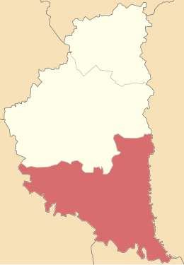
Raión de Chortkiv (en ucraniano: Чортківський район) es un raión o distrito de Ucrania en el óblast de Ternópil. La capital es la ciudad de Chortkiv.[1][2]
Comprende una superficie de 5022 km².[3]
Su territorio fue definido en 2020 mediante la fusión de la hasta entonces ciudad de importancia regional de Chortkiv con el propio raión homónimo y los hasta entonces vecinos raiones de Borshchiv, Búchach, Husyatyn, Zalíshchyky y Monastyryska.[1]
YouTube Encyclopedic
-
1/2Views:5 95230 665
-
Sfira and hadlaka on Lag Beomer in Nikolsburg
-
Horowitz family singing in Nikolsburg Chazzanut!
Transcription
Demografía
Según estimación de 2010, contaba con una población total de 76 447 habitantes en sus límites antiguos.
Subdivisiones
Tras la reforma territorial de 2020, el raión incluye 22 municipios:[4][5]
- 7 ciudades: Borshchiv, Búchach, Chortkiv (la capital), Joróstkiv, Kopýchyntsi, Monastyryska y Zalíshchyky.
- 8 asentamientos de tipo urbano: Hrymáiliv, Husiatyn, Korópets, Mélnytsia-Podilska, Skalá-Podilska, Tovste, Zavodské y Zolotí Potik.
- 7 municipios rurales: Bilche-Zoloté, Bilobózhnytsia, Ivane-Puste, Kolyndiany, Nahírianka, Trybujivtsi y Vasýlkivtsi.
Otros datos
El código KOATUU fue 6125500000. El código postal 48500 y el prefijo telefónico +380 3552.
Referencias
- ↑ a b «uk:Про утворення та ліквідацію районів. Постанова Верховної Ради України № 807-ІХ.». Голос України (en ucraniano). 18 de julio de 2020. Consultado el 3 de octubre de 2020.
- ↑ «uk:Нові райони: карти + склад». Міністерство розвитку громад та територій України (en ucraniano). 17 de julio de 2020. Consultado el 15 de abril de 2022.
- ↑ Ostapenko, Pavlo (Павло Остапенко), ed. (2020). uk:Атлас адміністративно-територіального устрою України: Новий районний поділ та територіальні громади: 2020 (en ucraniano) (2nd edición). Київ: Міністерство розвитку громад та територій України; Товариство дослідників України.
- ↑ Постанова Верховної Ради України «Про утворення та ліквідацію районів»
- ↑ Нові райони: карти + склад
- Oficina de estadísticas de Ucrania. (en ucraniano)
 Datos: Q2995475
 Multimedia: Chortkiv Raion / Q2995475